| HOME | WELCOME | CALENDAR & NEWS | PEOPLE | RESEARCH |
LABS |
ALUMNI |
CONTACTS |
Hydrology
Program & Research
From its founding in the 1950s, the hydrology program in the Earth and Environmental Science (E&ES) department at New Mexico Tech has been working across disciplines to answer water questions impacting society and the world. Our focus is on building scientific understanding of basic processes that shape global water sustainability one, five, ten and even fifty years in the future. The hydrology program has five full-time faculty members and close collaborations across the E&ES department. Additionally, we work closely with other research organizations at New Mexico Tech and the broader hydrologic community throughout New Mexico and the USA.
Research in the hydrology program touches on every aspect of the science of water, which has led the program to play a central role in the E&ES department. Major research areas include watershed and stream hydrology and geomorphology, basin-scale to continental-scale hydrogeology, hydrothermal and subsurface energy systems such as carbon capture and underground storage and geothermal energy, and hydrogeophysics.
Our research spans scales from the atomic, to the grain, and pore-scale to regional and continental scale processes, and, despite the small size of our institution, touch on nearly every aspect in between.
What is hydrology?
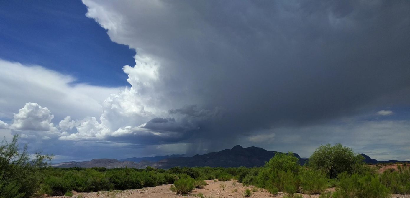
Monsoon precipitation over M Mountain outside of Socorro, NM. |
The field of hydrology answers questions about how much water there is and how fast is it flowing (physical hydrology), and what is in it and how its composition changes through time and space (chemical hydrology). This is necessarily broad: hydrologists study systems ranging from flow in tiny pores and cracks or at the scale of single sand grains, to a single reach in a stream or a single well in an aquifer, to a watershed or basin, to an entire continent or subducting plate boundary.
Within the water cycle, we work on everything involving water from the top of the tree canopy down through the part of the crust that allows flow – often down several kilometers. If you are worried about how much water a community has now or will have in the future, hydrologists are working on understanding these questions.
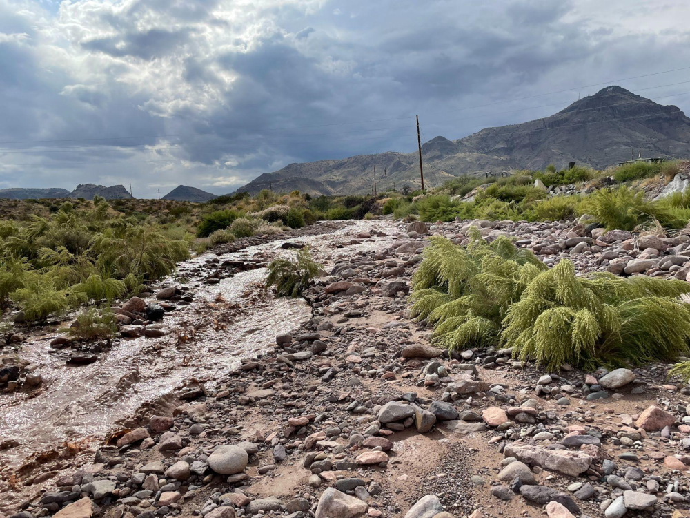
Post-Monsoon runoff in Socorro, NM. |
|
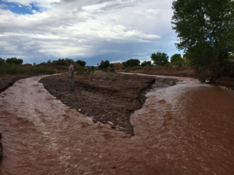
Dan Cadol stranded on a bar during a flash flood on the Arroyo de los Pinos. |
Hydrologists are involved with almost every aspect of our world’s response to climate change because of its direct impact on the hydrologic cycle. At New Mexico Tech, we are working on understanding climate change impacts from the top of the watershed to the sea. We are studying how increased forest fires and decreasing snowpack are impacting streamflows. Hydrologists are also responsible for providing the data and models for resilient management of groundwater both in wild areas and for farmers and cities as climate changes. These studies involve a mixture of direct measurements and using geophysics and satellite imagery to understand the world beyond human perception.
But hydrologists are also involved with mitigating climate change. Hydrologists work on teams to discover and develop geothermal energy resources. We work on teams to store energy and waste – like hydrogen, CO2 and nuclear waste – underground. This involves a mix of modeling and experimental work focused on flow and transport of fluids, water-driven chemical reactions, and understanding of earthquakes and induced seismicity.
Hydrologists also study surface water and floods by tracking water as it is transformed from rainfall to flow on hillslopes to streamflow. Hydrologists are developing new methods for flood prediction and warning that save lives and mitigate damage to property. Hydrologists also study sediment production and movement during floods as it impacts water resources and flood prediction. The history of floods, or the sedimentary record produced by past flows, is also one way to understand ancient climates, 100s to 10,000s, to 1,000,000s of years ago.
Hydrologists use combinations of field observations, laboratory measurements, and numerical models to answer questions across scales of space and time. Because of the inability to access the subsurface or even a small percentage of the surface of the Earth, we use a broad range of tools, often working across other disciplines (civil engineering, soil science, geochemistry, geophysics, sedimentology, geomorphology) to answer our questions.
Major divisions
Watershed and stream hydrology (Daniel Cadol and Kate Leary)
Water is the primary sculptor of Earth’s surface– eroding sediment from mountains and plateaus before conveying that sediment downstream via rivers and streams to the ocean. For centuries, rivers and their floodplains have served as resource centers vital to the evolution of human beings. They are also vital freshwater resources for flora and fauna. Understanding the interplay between rivers, human society, and ecology is key to understanding how Earth's surface evolves through time. Additionally, river deposits form the building blocks of the stratigraphic record. By understanding river dynamics in the present, we can shed light on river dynamics in deep time. Our group aims to understand the dynamics of river systems from the grain to watershed scales at present and in the geologic past.
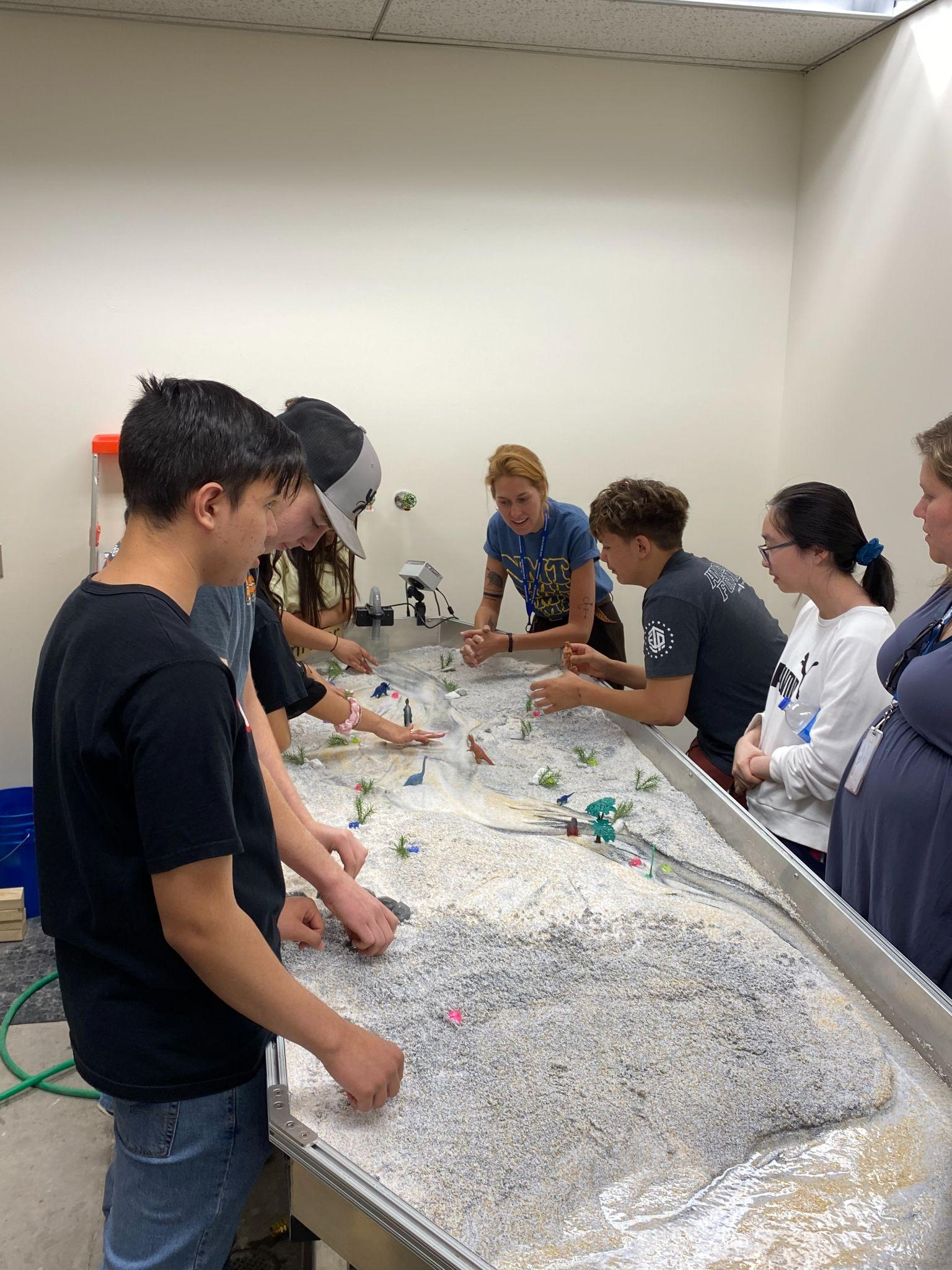
Students from Socorro High School exploring river dynamics in the EmRiver teaching and experimental stream table. |
|
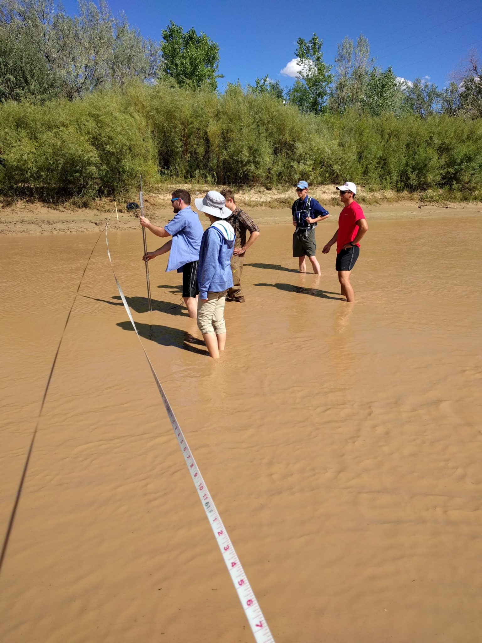
Students gauging the Rio Grande at Escondida. |
Dr. Cadol’s research includes field observations of water and sediment transport in ephemeral channels during violent floods at a state-of-the-art flume with sediment traps, ultrasonic bedload monitoring, stage monitoring, and seismic monitoring, as well as measurement of evapotranspiration, run-off and sediment production in burnt forests.
Dr. Leary’s research focuses on using experimental geomorphology to elucidate details of bedform dynamics in modern and ancient environments. In modern environments, Dr. Leary and her students investigate the grain scale dynamics of bedload transport over dunes as well as bedform dynamics through flood events. These experimental data not only provide glimpses into modern systems, but can be used to develop new process sedimentology statistical tools to interpret ancient river deposits. Dr. Leary and her students use these new tools to investigate paleoflow dynamics of ancient river systems such as the paleo-Rio Grande.
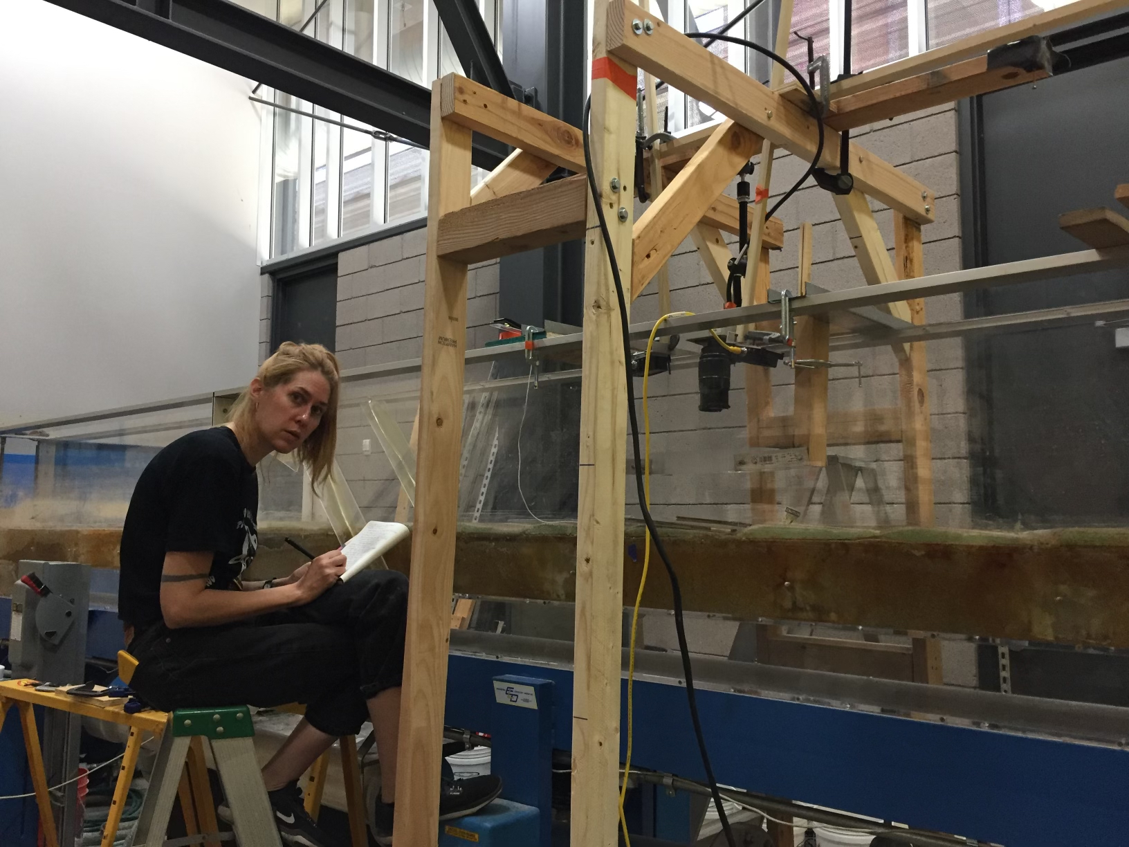
EES MSc student, Leah Tevis, conducting sediment transport experiments at the Arizona State University River Dynamics Laboratory. |
Hydrogeology (Mark Person, Alex Rinehart and Glenn Spinelli)
Groundwater flow isn’t just about the quantity of water in an aquifer, but also controls seismic hazard in subducting slabs, transport of contaminants such as radionuclides, the resilience of surface water supplies, and the presence of ancient freshwater on and offshore. Hydrogeology researchers at NMT combine a mix of numerical modeling, field observations and sampling for groundwater age, chemistry and isotopic composition, geophysical characterization including temperature, gravity and magnetotellurics, and more to understand flow of water in the subsurface.
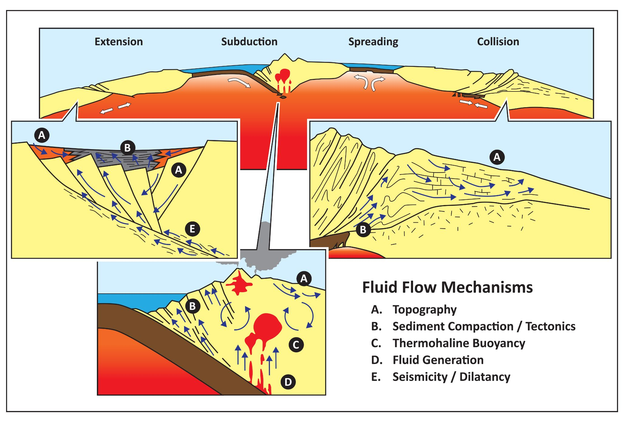
Schematic diagram depicting fluid flow impelling mechanisms within the Earth’s crust (from Person and Baumgartner, 1995). |
Hydrothermal systems and subsurface energy storage (Mark Person, Glenn Spinelli and Alex Rinehart)
Along with colleagues in geochemistry, the hydrology program has active research in the formation and flow of water in hydrothermal systems, as well as understanding how introducing CO2 and other external fluids to reservoirs changes the formation properties. Geothermal and hydrothermal systems occur where heat builds up faster than it can be advected out, leading to hot (>100°C) waters and possible overpressures.
Mark Person explores active and blind geothermal systems using a combination of geophysics (magnetotellurics), numerical modeling and geothermometry. Working on large teams and with colleagues such as Shari Kelley at the NM Bureau of Geology, Person has explored a number of geothermal systems around New Mexico.
Glenn Spinelli has been working on understanding the movement of heat and water in oceanic crust as it is subducted. He has used numerical simulations, detailed thin section analysis and rock property measurements, and ocean-bottom drilling and temperature measurements to understand these systems.
Alex Rinehart has been leading a team of researchers in the hydrology program and at the Petroleum Recovery Research Center on exploring how the introduction of CO2 for long-term storage changes the strength, permeability and chemistry of the storage formations. He primarily uses high-pressure, high-temperature experiments to mimic subsurface conditions followed by detailed thin-section and higher resolution observations to understand the type and degree of damage. Additionally, his labs measure relative permeability and mutilphase-flow properties of rocks.
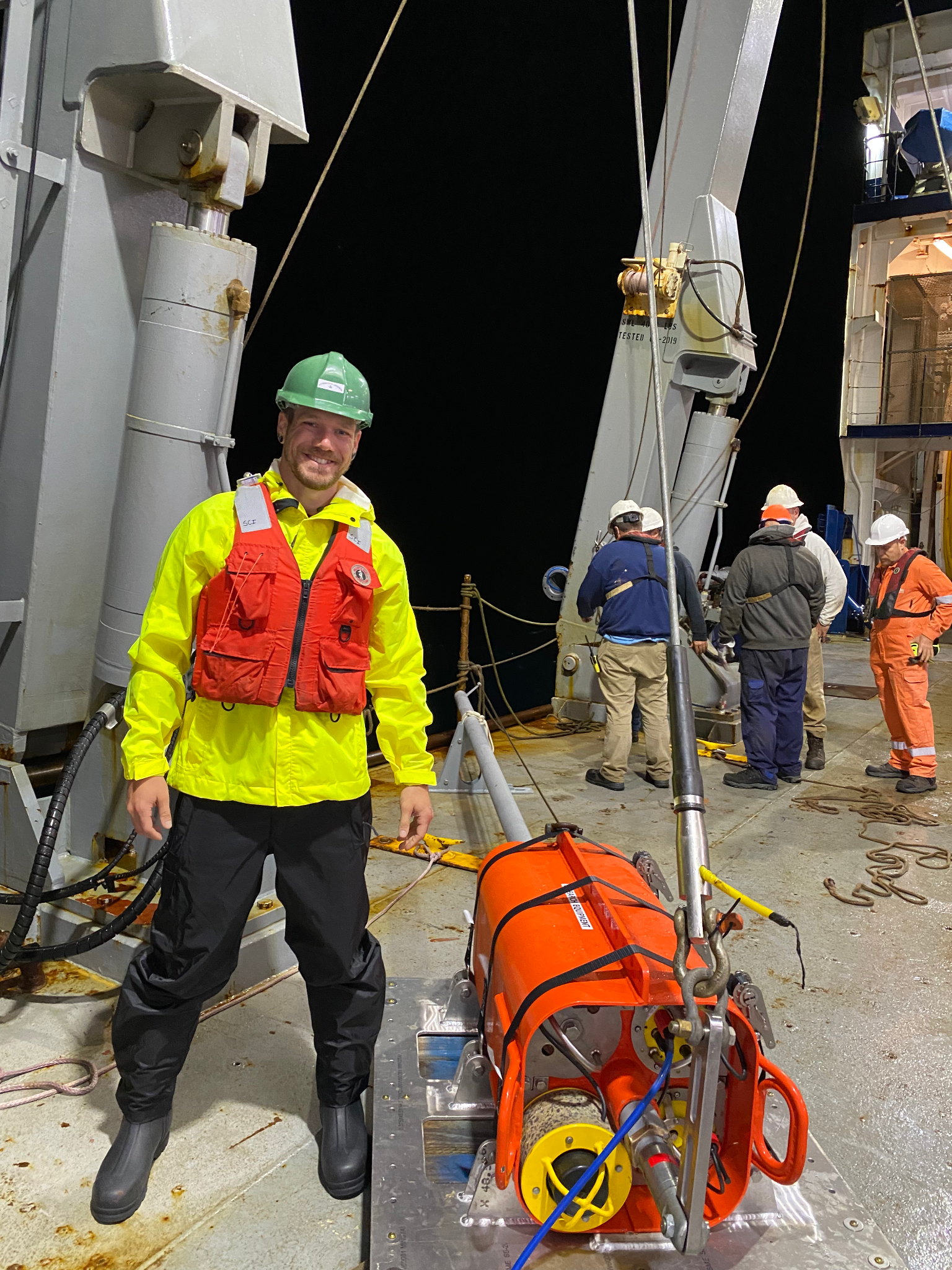
EES MSc graduate, Matt Perry, preparing to deploy a heat flow probe offshore Oregon (on a research cruise with Glenn Spinelli). |
|
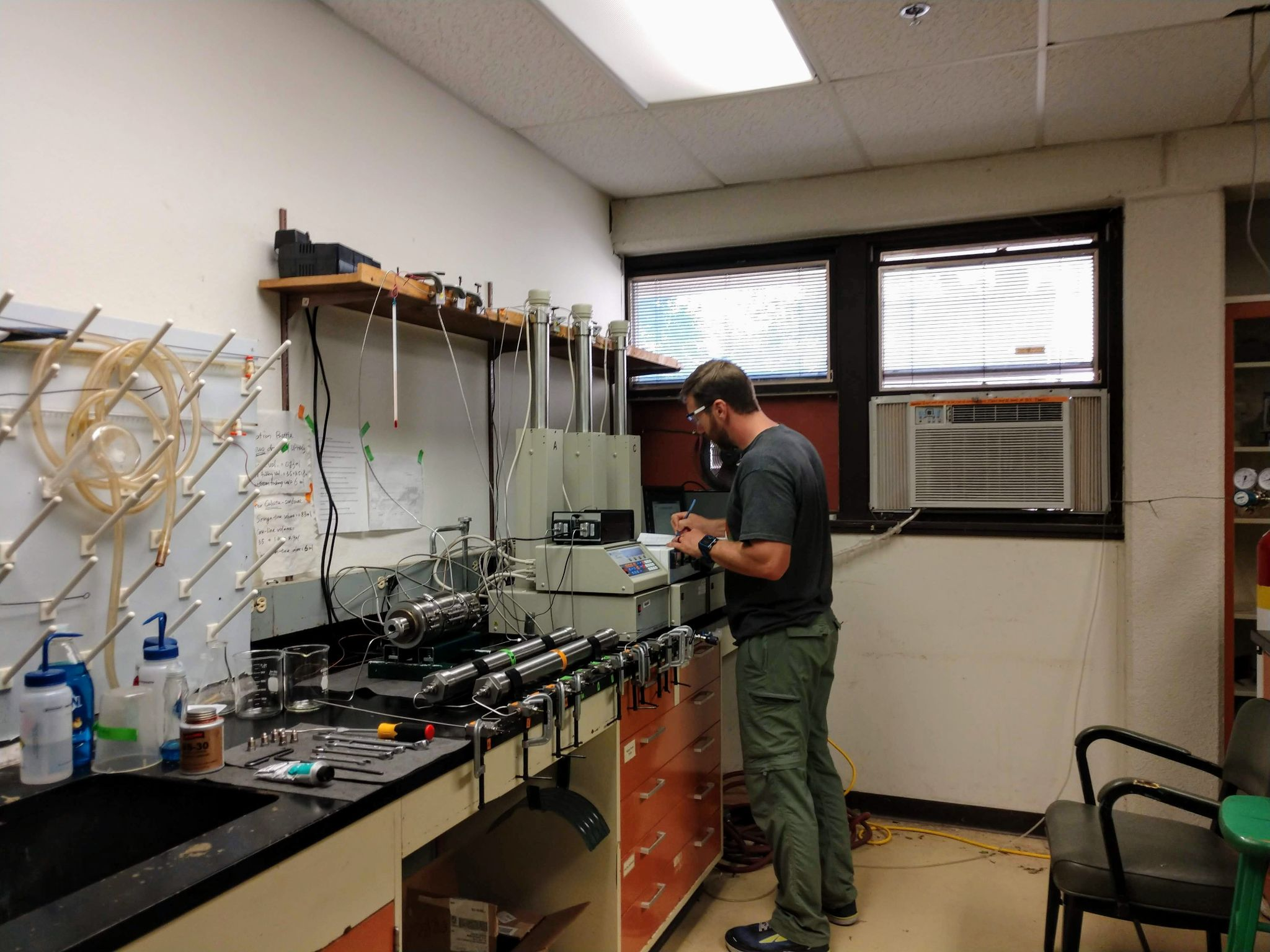
Former NMT MS student and now PRRC research associate Jason Simmons running high-pressure, high-temperature flow-through experiments to understand formation damage during CO2 injection and storage. |
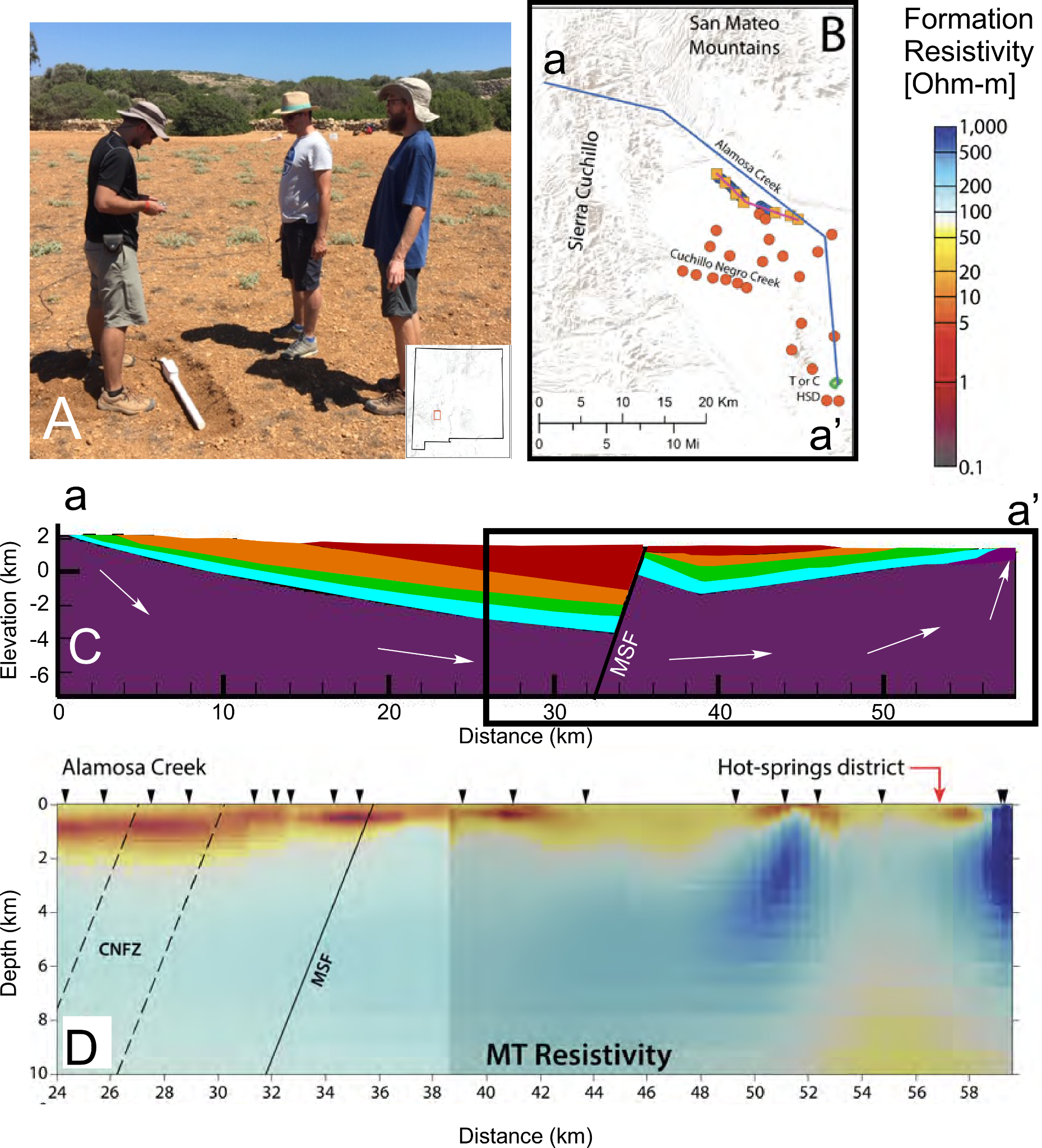
Figure (A) Photo of field deployment of magnetometer as part of the Truth or Consequences magnetotelluric (MT) field campaign. (B) MT sites near Truth or Consequences. (C ) Idealized geologic cross section showing fractured, permeable crystalline basement rocks (purple), aquifer/confining units system (turquoise to orange), and Tertiary basin fill (red). Not that sedimentary units are absent due to erosion near the Hot Spring District. White arrows denote groundwater flow system through the crystalline basement. We hypothesize that along the flow path, groundwater is heated to > 100 °C. Fluid-rock interactions increase salinity of up to 2000 mg/l. Under these conditions, rock formation resistivity becomes more conductive (higher values). (D) Formation resistivity map along flow path (source: Pepin, 2019). |
Hydrogeophysics (Susan Bilek, Dan Cadol, Alex Rinehart, and Glenn Spinelli)
As part of her research program in environmental seismology, Bilek used seismic energy
produced from shallow/surficial processes to help characterize environmental forces such as water and bedload transport. Her current projects in this area include characterizing flow in a shallow karst aquifer in northern Florida as well as tracking bedload movement during monsoon flash floods in New Mexico and Israel. These projects are heavily interdisciplinary, with colleagues in hydrology, geodesy, and geomorphology all involved in field data collection and analysis.
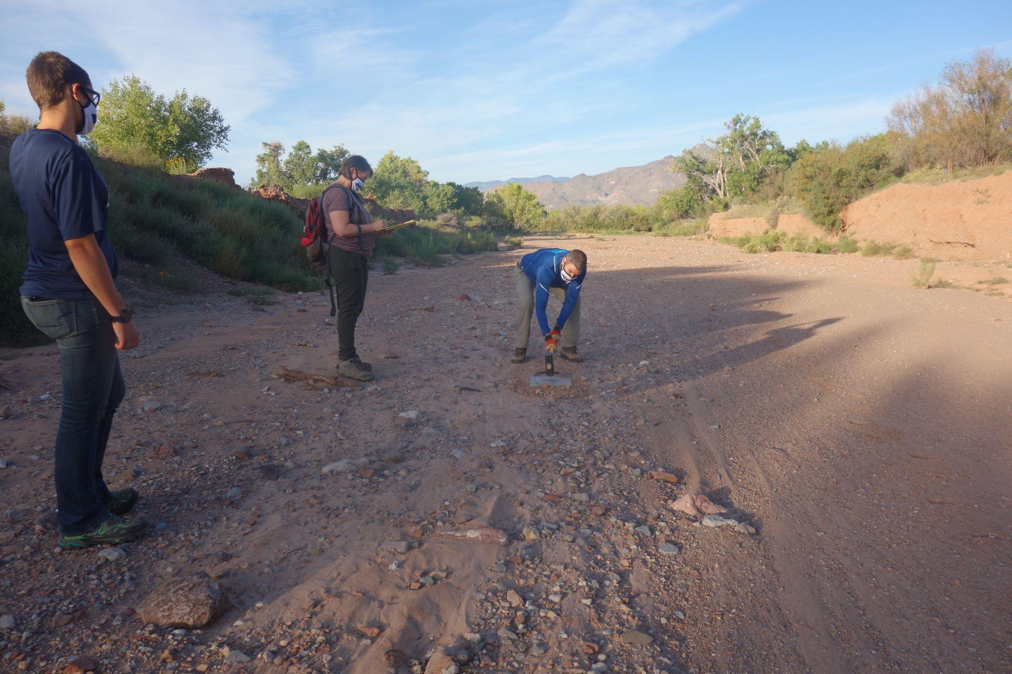
Bilek, Spinelli and students conducting a shallow geophysical hammer survey (Spinelli is swinging the hammer!) at the Arroyo de los Pinos site to characterize the shallow velocity structure and determine depth-to-water table. This is part of a larger study using a seismic network to understand bedload and turbulent water flow in channels. |
|
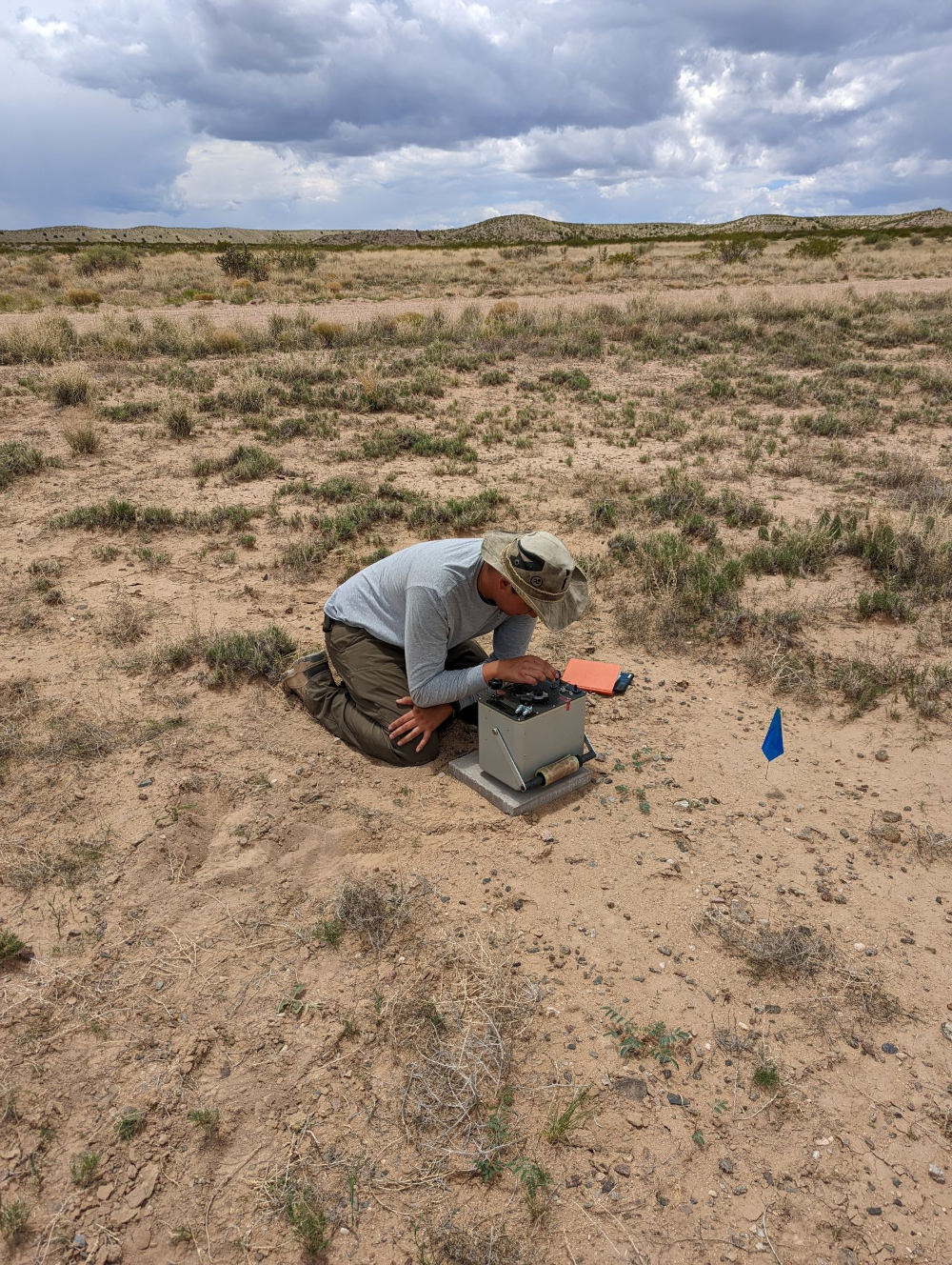
An undergraduate student running a regional gravity survey on the Sevilleta National Wildlife Refuge. |
|
|
Spinelli has ongoing research focused on fault-zone permeability and hydrology. This work couples well monitoring, electrical resistivity and impedance surveys and detailed outcrop and thin-section geology of sandstones along the Rio Grande rift.
Rinehart is working on using surface deformation and gravity measurements to understand movement of water in the subsurface. He has run repeat gravity surveys to understand surface water-groundwater interactions. He has also led efforts with undergraduate students to conduct regional gravity surveys to understand basin geometry, and, in turn, how that controls large scale groundwater flow. He is also working with Bilek and collaborators to link how surface deformation can be used to understand aquifer properties across scales rather than being limited to single wells.
Faculty and teaching
Susan Bilek. Source physics and environmental seismology
- GEOP 523 Theoretical seismology
- GEOP 524 Observational seismology
- GEOP / GEOL 558 Mechanics of earthquakes and faulting
- GEOP 589 Environmental seismology
Daniel Cadol. Watershed and stream processes, forest fire hydrogeomorphology
- GEOL 340 Global climate change: Origins and impacts
- GEOL 440 Hydrological theory and field methods
- GEOL 413 / HYDR 513 Watershed dynamics and ecohydrology
- HYDR 508 Flow and transport in hydrologic systems
- HYDR 534 Introduction to remote sensing
Kate Leary. Fluvial geomorphology and process sedimentology.
- GEOL 2320 Earth surface processes and landforms
- HYDR 508 Flow and transport in hydrologic systems
- HYDR 589 Geojustice
- HYDR 562 Fluvial Geomorphology
Mark Person. Hydrogeology and hydrogeophysics.
- HYDR 510 Quantitative methods
- GEOL 411 / HYD 511 Groundwater hydrology
- HYDR 547 Groundwater modeling
- HYDR 516 Geofluids
Fred Phillips (Emeritus). Hydrogeology, environmental tracers and cosmogenic nuclide geochronology
- HYDR 572 Special topics: Scientific methods in the earth sciences
- GEOL 340 Global climate change: Origins and impacts
Alex Rinehart. Hydrogeophysics, subsurface energy storage and environmental rock mechanics.
- GEOL 440 Hydrological Theory and Field Methods
- GEOL 414 / HYD 514 Vadose Zone Hydrology
- HYDR 558 Environmental Tracers
- HYDR 556 Rock Fractures in Geologic Settings
- HYDR 555 Natural Complexity
- MTH 587/GEOP505 Time Series Analysis
- GEOL 482/HYDR 572 Engineering Geology
Glenn Spinelli. Marine hydrogeology, fault zone hydrology and sedimentology and sediment properties.
- GEOL 2340 Introduction to Earth Structure & Composition
- GEOL 325 Near-Surface Geophysics
- GEOP 589 Subduction System Processes
John Wilson (Emeritus). Hydrogeology and karst hydrology
